What is GIS?
A Geographic Information System is a computerized system for managing large amounts of information and is capable of assembling, storing, manipulating, and displaying geographically referenced information, (e.g.) data identified according to their locations. Practitioners also consider the total GIS as including operating personnel and the data that is placed into the system. GIS technology can be used for database management, spatial analysis and modeling, scientific investigations, resource management, and development planning. For example, a GIS might allow emergency planners to easily calculate emergency response time in the event of a natural disaster, or, a GIS might be used to find wetlands that need protection from pollution.
About GIS in Santa Clarita
The Geographic Information Systems (GIS) Group in the Administrative Services Department was created to obtain geographic data about the City for the purposes of map production and geographic analysis for the City. The GIS group creates and maintains a wide range of spatial data from zoning to bus routes to natural hazard areas. Access to accurate and current updated maps available is beneficial in assisting in property evaluation, parcel-related research, land-use planning, site selection and environmental management.
The GIS Division primarily uses ESRI products and such as ArcGIS 11.x, ArcGIS Pro 3.x, and ArcGIS Enterprise Server.
Standard Maps of the City
PDF maps for viewing and printing online.
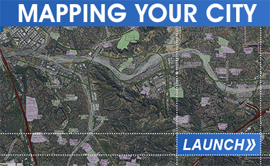
Interactive Mapping Online
This application allows web site visitors the ability to search and view property information within the City of Santa Clarita.
Note: If you get an error when accessing this system, clear your browser’s cache and try again.
LA County Assessor “Property Assessment Information System” website.
Contact Us
Email address:
gis@santaclarita.gov
Phone number:
Technology Services
(661) 286-4070
Address:
GIS (Technology Services)
Administrative Services Department
City of Santa Clarita
23920 Valencia Blvd. #290
Santa Clarita, CA 91355
Staff:
Andrew Allevato – Senior GIS Analyst
Anthony Calderon – GIS Technician
Christopher Hernandez – IT Specialist