
Transition to District Elections
The City of Santa Clarita has historically operated an at-large election system, which meant that registered Santa Clarita voters elected the five City Councilmembers regardless of where the candidates resided in the City. Pursuant to the terms of a settlement agreement, the City instituted district-based elections for the City Council seats starting with the 2024 City Council election. In this new, by-district election system, the City of Santa Clarita is now divided into five districts, and each voter within a district may cast one vote for a candidate residing within that same district when that seat is vacated.
Regular elections will continue to be consolidated with statewide general elections in November of even-numbered years to fill expired City Council terms. The City has always operated staggered elections, and Councilmembers serve staggered four-year terms. Pursuant to the settlement agreement, two district seats were voted upon in November 2024, so the remaining three district seats will be up for election starting in November 2026. Until the November 2026 election, those three Councilmembers remain at-large.
Final Map
Use the “Look up My Residency Details” button above or click on the map below to identify your District.
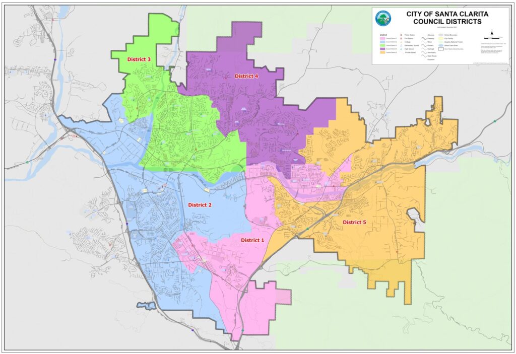
This map reflects the district boundaries and population distribution among districts established by the City Council; with minor adjustments where needed to conform to the Los Angeles County Registrar’s GIS specifications that district lines track parcel boundaries.
/* OLD MENU DO NOT USE */